On this page 11 sections
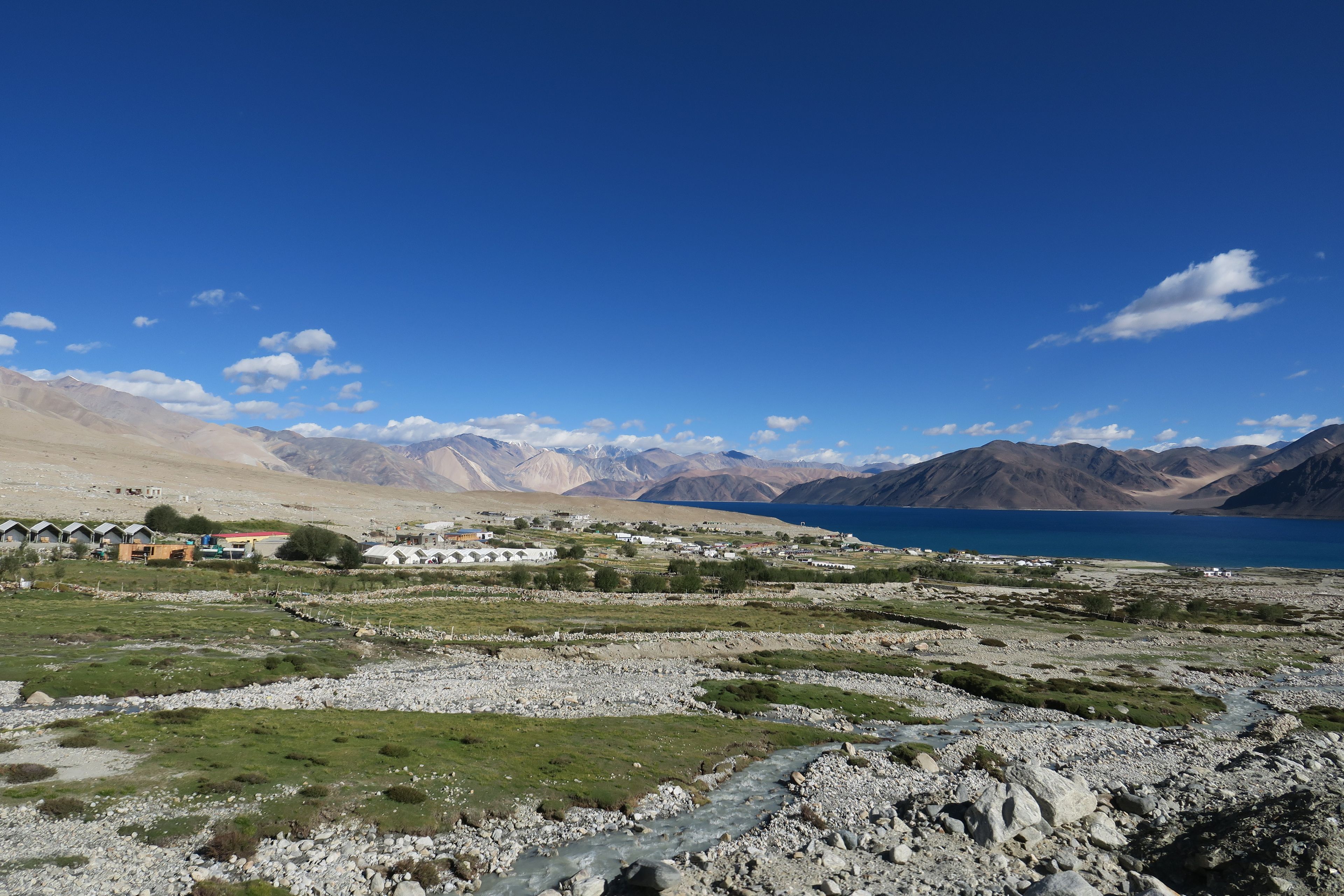
Pangong Tso is one of the most famous lakes in India, and a landscape that makes visitors fall silent. At around 4,350 metres, it stretches for 134 km, a long ribbon of water, about a third in India and the rest across the border in Tibet. The colour shifts through the day, from deep blue to turquoise, grey and green. It has appeared in films and countless photographs, but the reality is quieter and starker.
What Pangong is like
The lake is brackish and does not freeze in summer, but its edges ice up in winter. Mountains in shades of brown and violet rise from the shore, and there is very little vegetation. The area is windswept and cold, and the sense of remoteness is strong. Camps at Spangmik, Maan and Merak sit by the water, offering basic accommodation. Most visitors spend one night, long enough to see sunset and sunrise.
The journey
From Leh, the road climbs over Chang La, a pass at about 5,300 metres, then descends along the Tangtse valley to the lake. The drive takes five to six hours. The road is rough in parts, and travel can be slow. Many itineraries combine Pangong with Nubra, via Shyok, in a loop, which adds a long day.
Altitude and cold
Pangong is higher than Leh, and the night spent there can be difficult, even for acclimatised travellers. Headaches, poor sleep and nausea are common. Temperatures at night often fall to freezing, even in summer. We strongly recommend spending at least three days in Leh first, drinking plenty of water, sleeping with extra blankets and avoiding alcohol. If someone feels very unwell, descend to a lower altitude.
Camps and facilities
Camps are basic: tents or simple cottages, with shared or attached bathrooms, limited hot water and generator-powered electricity for a few hours. Meals are simple. Mobile coverage is almost absent, and there are no ATMs. The best camps have thicker bedding, heaters and better food, but nothing is luxurious. Ask about the distance to the water, the bedding and the bathrooms.
Permits and rules
Entry to Pangong has had permit requirements, and rules have changed over time. We confirm the current requirements with the authorities and handle any paperwork. Carry government photo ID. Photography near military areas is prohibited. Some parts of the lake are off-limits.
What to do
- Watch the colours of the lake change through the day.
- Take photographs at sunrise and sunset.
- Walk along the shore, but do not go far.
- Stargaze on clear nights.
- Visit Spangmik village and its small community.
- Sit and absorb the silence.
Best time to visit
June to September is the main season. May and October are cold, with some roads closed. The lake looks different in each season, but the colour is often best on clear summer days.
What to bring
- Warm layers, thermals, a heavy jacket, gloves and a woollen cap.
- A good sleeping bag or extra blankets if you are sensitive to cold.
- Sunscreen and sunglasses.
- A torch.
- Cash, because ATMs are not available.
- Basic medicines and a power bank.
Responsible travel
Pangong is a fragile environment. Do not litter, and take your waste back to Leh. Avoid single-use plastics. Do not disturb wildlife such as birds and marmots. Keep noise low at night, and support local community camps.
The lake in context
Pangong Tso is about 134 km long and only a few kilometres wide at its broadest, and it spans the border between India and China. Its water is brackish, so little lives in it besides some tiny crustaceans, but the shore and the nearby marshes attract migratory birds in summer, including bar-headed geese and brahminy ducks. The colours come from the depth, the light and the minerals in the water, which is why the lake can look deep blue at sunrise and pale green at noon. It is a landscape to sit with, not to rush through.
Plan Pangong with us
Pangong is part of our Ladakh classic tour. Tell us your dates and we will advise on altitude and camps.